Aerial Progress Viewer for Green Park, Austhorpe
A clear browser-based project record combining 3D model, orthophoto, DSM and Google Earth context. Built to show how repeat drone capture can give CLS Sports a simple, shareable view of site progress, surfacing work areas, access, build sequence and change over time without sending large files around.
One link. Monthly progress record.
Each future capture can be added to this same viewer. CLS Sports would not need a new link each month — they simply open the same URL and click the relevant month to review the latest update or look back at previous captures.
What this gives the project team
The value is not just the drone imagery. It is the ability to keep a repeatable visual record in one link that can be opened by contracts managers, directors, clients and site teams without specialist software.
Repeat capture gives a clear record of what has changed between visits.
Large models, maps and imagery can be reviewed through a single browser page.
Useful for showing access, work zones, surfacing progress and broader site context.
The same link can become a month-by-month record rather than a one-off image set.
Interactive 3D Site Model
The 3D model gives a quick visual understanding of the site layout, surrounding context, working areas and progress. It is useful for people who need to understand the site but are not opening CAD, GIS or survey software.
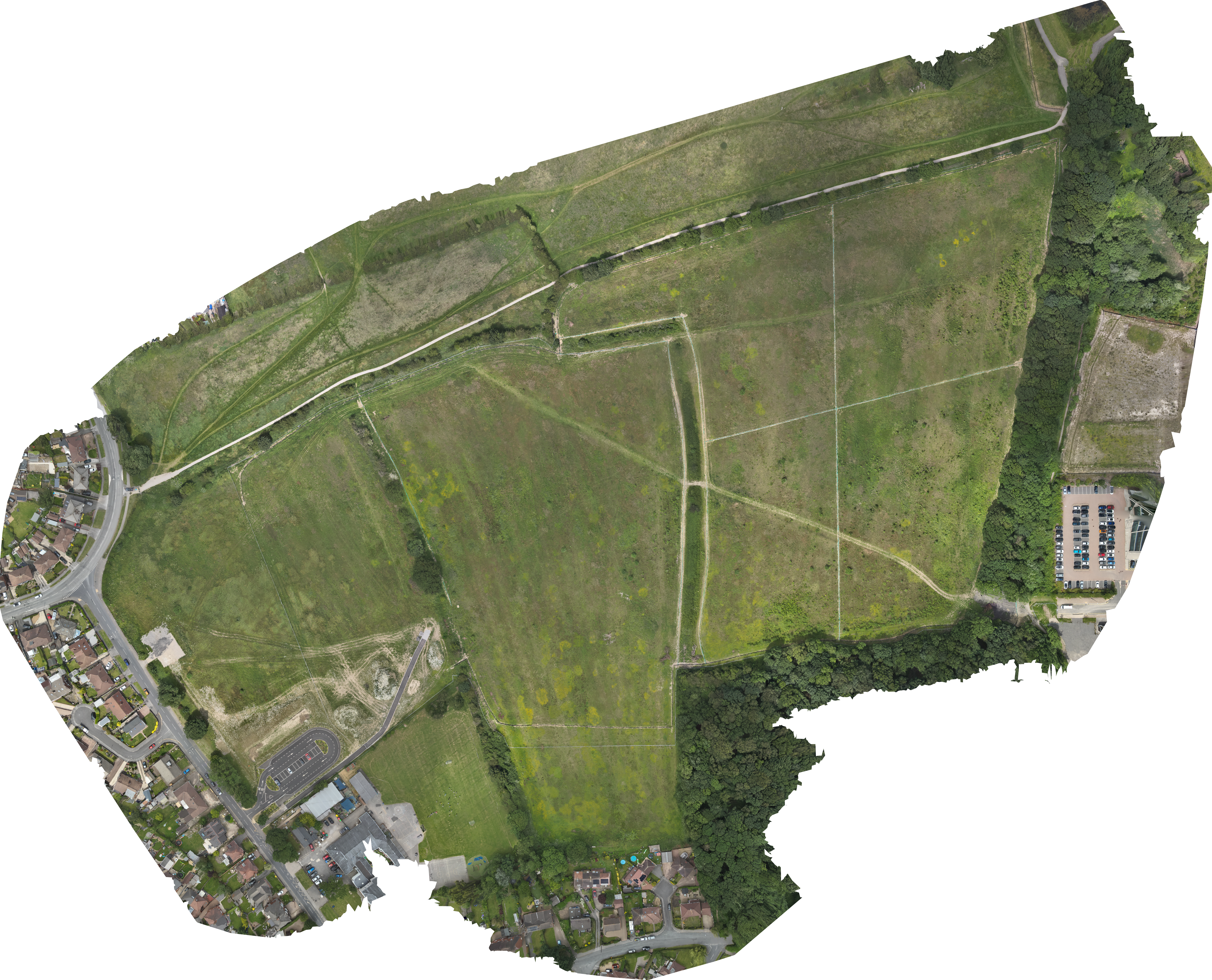
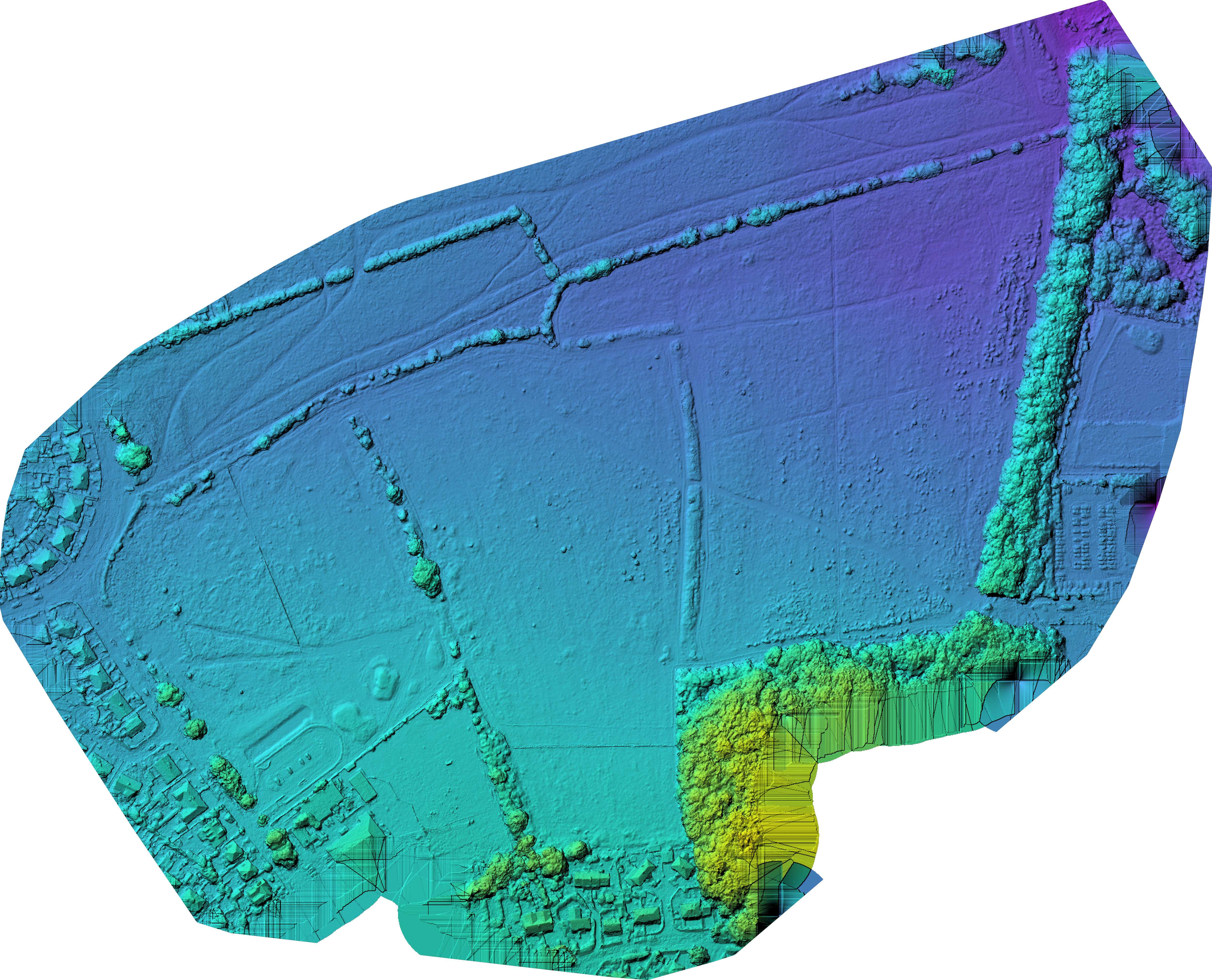
Orthophoto and DSM Slider
Drag the handle to compare the orthophoto with the DSM. The orthophoto gives a clean plan-view record of the works; the DSM adds surface context, helping the team understand broad changes in levels, formation and site shape.
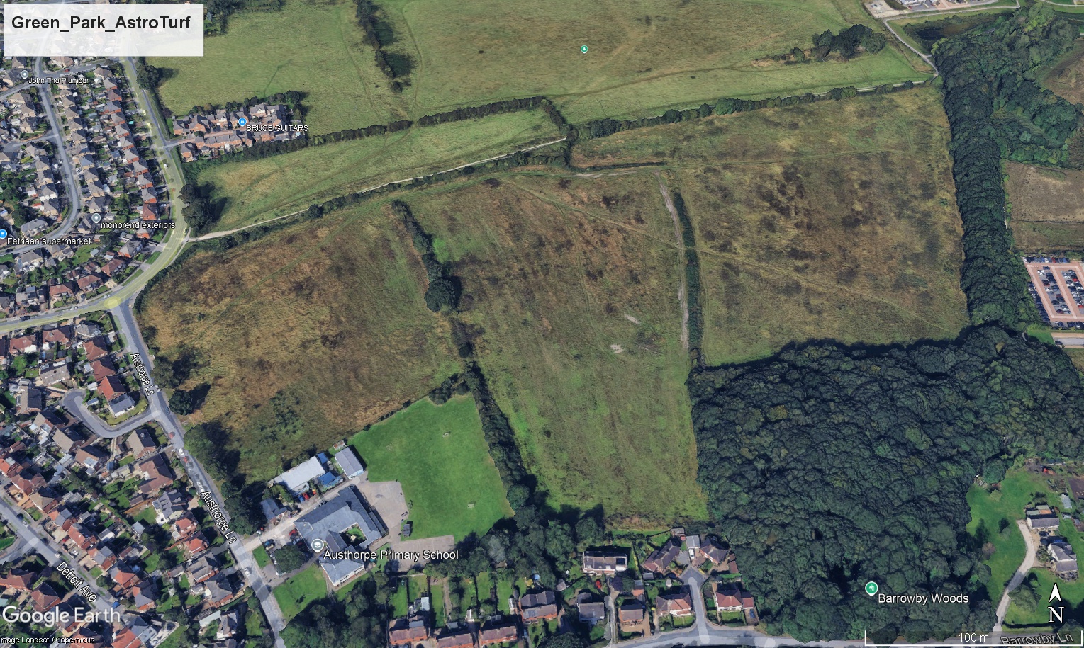
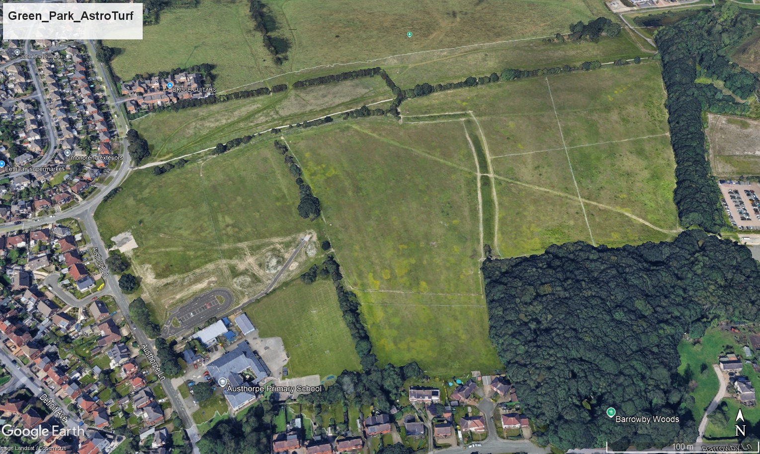
Google Earth Before / After Fader
Use the fade control to compare the historical Google Earth view against the current site overlay. This is a strong client-facing way to show change over time and communicate progress without needing the viewer to understand mapping files.
Public Project Context
These logos are included as public project context only. The viewer itself is prepared by Vista Metrics for CLS Sports review and does not imply appointment by, or partnership with, the organisations shown below.
Downloads
Supporting files from this capture are available below. Keeping them in one place makes the viewer more useful as a continuing progress record.
Before / After Images
Exported Google Earth context images used in the change fader.
Download After Image